Services
Land Surveying Services
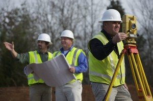
 Alley, Williams, Carmen and King offers a full range of Land Surveying services using both GPS and conventional methods. AWCK’s field crews collect the data needed to complete projects in a timely manner. Our GPS surveying utilizes RTK (Real Time Kinematic) network positioning based on the North Carolina VRS (Virtual Reference Station) network. AWCK also provides mapping grade surveying for GIS applications using Terrasync and Arcview for mapping. Our conventional surveying equipment includes the latest Total Stations and Data Collectors operated by our experienced field crews. With three Professional Land Surveyors on staff, AWCK can assist you with the following Land Surveying Services :
Boundary Survey – A boundary survey determines the location of land ownership lines based on the most recent deeds and recorded plats of not only the subject property but adjacent properties as well. This is done using a combination of these deeds and plats and evidence collected in the field (physical monuments marking property corners). Any improvements along the boundary affecting the use or title to the property are located, such as fences, drives, utilities, buildings, sheds, creeks or other water features. Missing corner markers will be replaced and a report or map showing the boundaries and improvements along the boundaries must be produced.
Location Survey – A boundary survey with the additional location of all of the interior improvements such as buildings, utilities, sidewalks and drives, etc., that are not close to the boundary lines. Missing corner markers will be replaced and a report or map showing the boundaries as well as all of the improvements on the subject property must be produced. Mortgage or Loan Surveys fall into this category as this is the type of survey sometimes required by lending institutions and title insurance companies.
 Topographic Survey – A survey locating all improvements and topographic features such as: elevations of the land, embankments, contours, trees, water courses, roads, ditches, utilities, etc. This survey can be used in conjunction with a Location Survey in order to prepare a Site Plan (or Site Design Map), a Subdivision Map, or an Erosion Control Plan.
Site Planning Survey – This survey uses a boundary and a topographic survey as a base to design future improvements. It can be a design for a residential house or subdivision, a commercial shopping center or business, a new road or just about anything. This survey gives the planner, engineer, architect or whomever, an accurate picture of existing conditions, both horizontal and vertical, as well as the property line locations.
Subdivision Survey – Most counties and municipalities have an ordinance that regulates parcels of land. Typically a subdivision is when an existing parcel of land is divided into two or more smaller tracts. Ordinances vary but usually there are exceptions to the definition of subdivision such as the recombination of existing parcels, a court-ordered survey (the division of land for an estate settlement) and very small parcels that are divided into no more than two tracts. Barring these exceptions a subdivision survey must adhere to the regulations of the governing ordinance for things such as lot size, minimum lot width, etc. A subdivision plat must be prepared on mylar for the purpose of recording at the courthouse showing the course and distance of every line surveyed (each line of each lot or parcel) and meet the requirements of General Statute 47-30 which regulates mapping requirements for subdivision plats. There are many restrictions that apply to subdivisions and a great amount of planning which usually includes a topographic survey. Planning may include streets, storm drainage systems, flood studies and many other things.
Construction Stakeout – Both Commercial and Residential. Using surveying techniques to stake out commercial buildings, houses, utilities, sidewalks etc. for the purpose of construction. This includes both horizontal and vertical location for grading, setting offsets and final as-built surveys for assurance that whatever it was it was built to plans or specifications.
ALTA Survey – The American Land Title Association has a detailed set of standards that a surveyor must adhere to in order to insure that the survey produced is reliable enough for the issuing of title or mortgage insurance. They are very complex surveys and can take weeks to complete and are usually performed on commercial properties. The request for this survey must be in writing and be accompanied by all of the deeds and easements affecting the subject property as well as the deeds to adjoining properties.
Flood Elevation Certificates – A community’s permit  file must have an official record that shows new buildings and substantial improvements in all identified Special Flood Hazard Areas (SFHAs)are properly elevated. This elevation information is needed to show compliance with the floodplain management ordinance. FEMA encourages communities to use the Elevation Certificate developed by FEMA to fulfill this requirement since it also can be used by the property owner to obtain flood insurance. Communities participating in the Community Rating System (CRS) are required to use the FEMA Elevation Certificate. (This definition from FEMA web site.)
GIS Survey – Many municipalities and counties as well as professionals and businesses now utilize a multi-layered Geographic Information System (GIS) that integrates hardware, software, and data for analyzing, managing and displaying all forms of geographically referenced information. Using survey grade or mapping grade GPS (Global Positioning System) technology, AWCK can collect data for these GIS systems such as the location of streets, homes, electric, phone & gas utilities, water & sewer systems, property lines, soil & vegetation types, water courses, etc. for use in future planning, preservation, and development.
Wetland Delineation Location & Mapping – AWCK works with a wetland delineation firm to locate and map wetlands and streams throughout tracts of land prior to permitting of those properties for future development. The delineation is done by an outside consultant and then AWCK provides maps to the owner certifying the accuracy and allowing for the owner to plan for and to minimize impacts to the streams and wetlands.
Phase II Stormwater Mapping – As part of the NPDES Phase II Stormwater Program, AWCK has worked with clients to create a Municipal Separate Storm Sewer System Map (MS4). This MS4 map shows all outfalls, storm drains, and associated drainage areas. The creation of this MS4 map is an important first step in the development of an Illicit Discharge Detection and Elimination Program (IDDE) and provides valuable information when trying to determine the source of an illicit discharge. In addition, this makes tracking, reporting, and responding to an illicit discharge much easier. To map storm sewer systems as accurately and economically as possible, we collect field data using a Trimble GPS system with a hand held GIS unit. Stormwater system information is entered on a handheld unit by a series of predefined pull-down menus and pick lists, thus increasing data entry accuracy. The mapping is performed to a minimum relative accuracy of 0.5 meters, satisfying the North Carolina Board of Examiners for Engineers and Surveyors rules. At the same time, pre-determined attributes for each stormwater structure such as size, material, condition, etc. could be collected. The MS4 Map would be provided in both AutoCAD and GIS formats for better use by our clients. This gives them the ability to easily facilitate annual permit reporting, and collect and track items such as MS4 maintenance activities, confirmed or suspected illicit discharges, and citizen complaints of flooding or water quality.
North Carolina Department of Transportation Services – AWCK is an NCDOT approved Private Consulting Firm for the following surveying tasks: Boundary and Site Surveying, Easement Surveying, Surveying for Trail Design and Layout of Trails, Route Location Surveying, Surveying for Highway Design and Topographic Surveying.


